Assessing air pollution exposure in disadvantaged communities
|
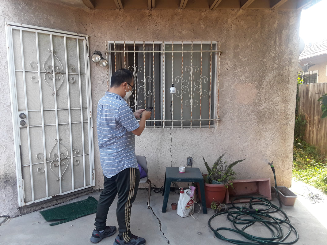
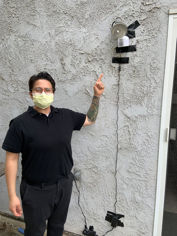
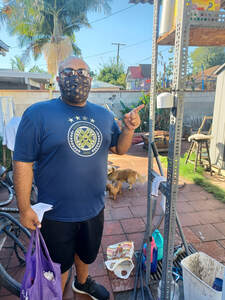
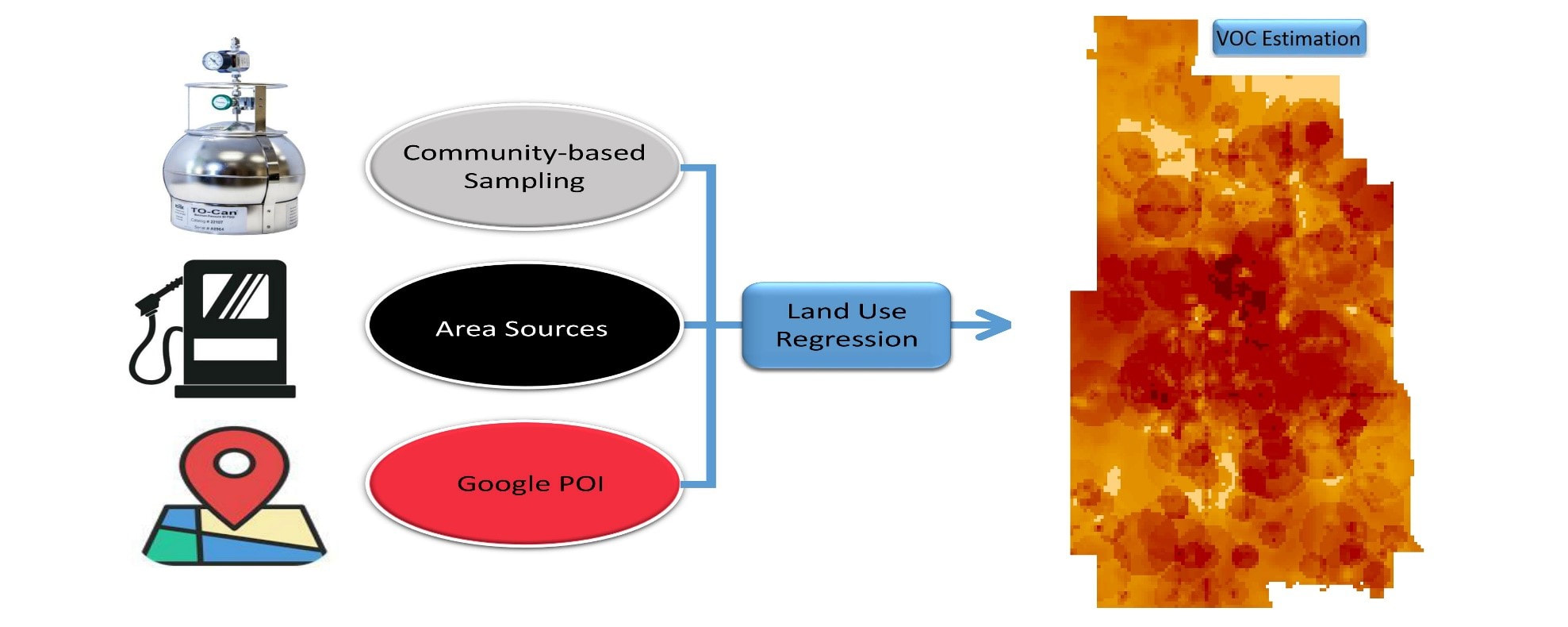
Environmental inequality has drawn serious attention in the US from the 1980s. Disadvantaged communities tend to be exposed to higher air pollution concentrations. Emerging low-cost sensors potentially increase the air monitoring density and coverage and supplement regulatory monitoring networks. Questions remain on how disadvantaged communities could benefit from citizen science and low-cost monitoring to understand air pollution exposure.
My study launches a low-cost sensor network in disadvantaged communities with participation of local residents and explores spatial and temporal patterns of air pollution:
|
|
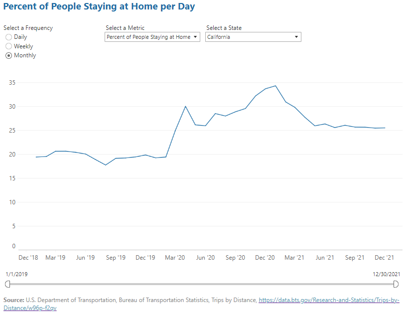
uNVEILING STATEWIDE PATTERNS AND TRENDS OF TELECOMMUTING
|
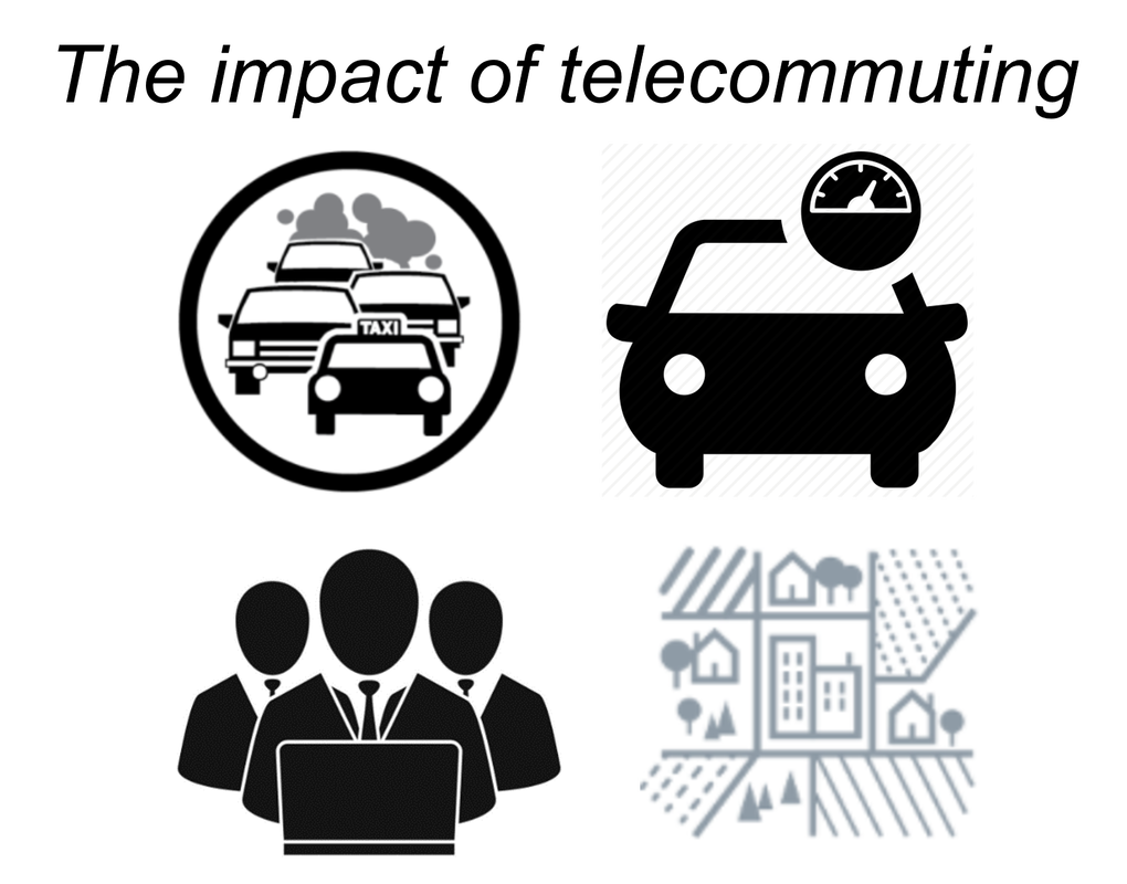
Telecommuting - which enables employees to perform job tasks remotely at home - has grown steadily in the last few decades. Telecommuting has been widely used to control spread of viruses and has shifted California's transportation patterns significantly. These changes raise important questions about factors that may impact telecommuting levels before, during, and after the pandemic, and how telecommuting is associated with socio-demographic information, transportation patterns, employment, land-use patterns, and emissions.
My study explores the associations between factors and telecommuting patterns before and during the pandemic in California, thus characterizing the telecommuting trends:
|
|
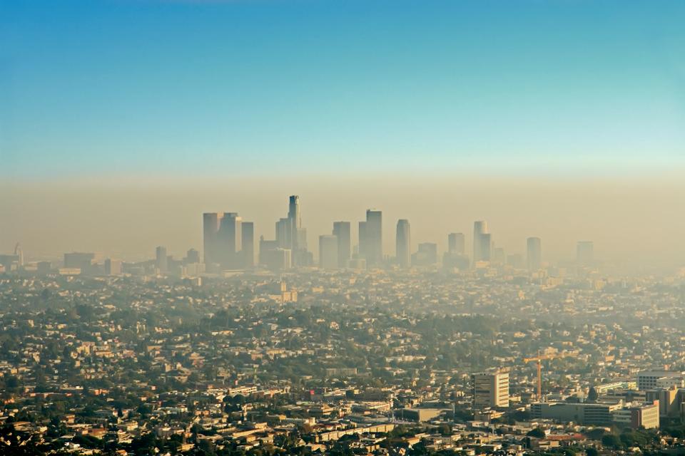
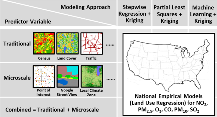
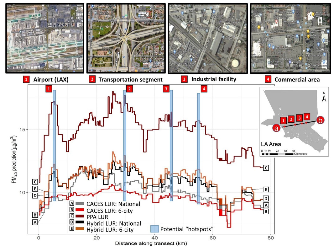
developing air pollution models for exposure assessment
|
Improving urban air quality is an essential component of planning for healthy cities. This understanding has facilitated studies on developing citywide and nationwide air pollution models that use monitoring network (e.g., Environmental Protection Agency [EPA]) and neighboring geographic variables to estimate air pollution concentrations at unmonitored locations. An understudied topic is whether effects from local emission sources should be considered. Questions remain on how to develop generalizable national models that allow for comparison of air pollution estimates for exposure assessment.
My study explores how different modeling inputs and techniques could influence model performance, thus informing air planning and community health policies:
|
|
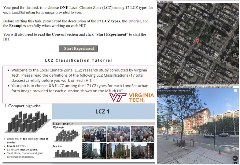
Urban form’s impact on air quality
|
Urban form that characterizes the physical and spatial configurations of land use and transportation is normally linked to urban air quality. A limited empirical studies have explored the relationship between urban form and air quality. Among them, Census-based variables that don't account for urban morphology (e.g., building height, form) are used. However, a metric from urban heat island studies (i.e., Local Climate Zones [LCZ]) allows for characterizing urban morphology in a consistent manner worldwide. Questions remain on what types of urban development (compact vs. sprawl) are sustainable scenarios for clean cities.
My study explores the impact of urban form on air quality using remote sensing, crowd-sourcing, and deep learning approaches:
|
|
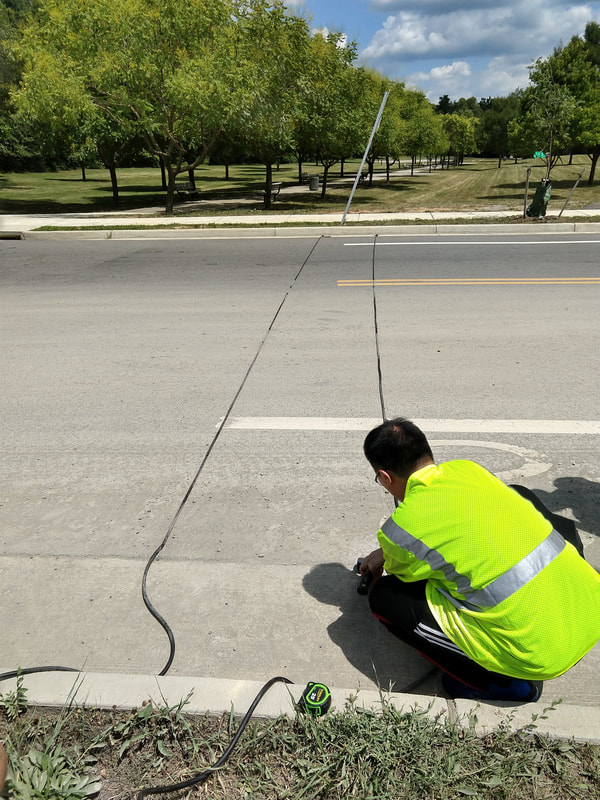
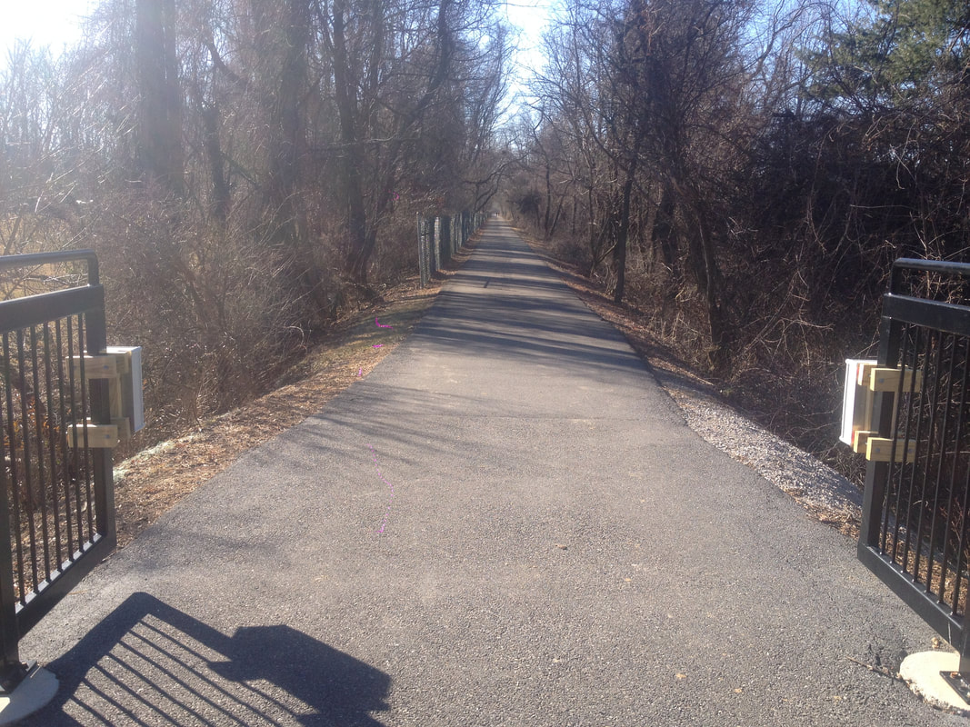
physical activity measurement and modeling
|
Non-motorized transportation (e.g., biking and walking) is an energy-efficient alternative to motorized travel and a solution to the environmental impacts of transportation. However, information on the spatial and temporal patterns of non-motorized traffic is required to inform decisions aimed at promoting physical activities.
My study explores best practices of non-motorized measurement and modeling:
|
|
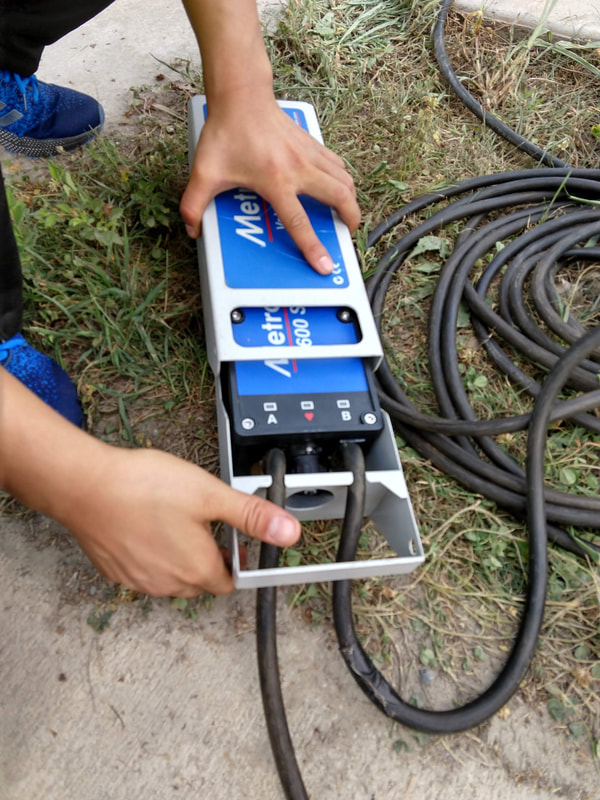
MetroCount pneumatic tube: bike |
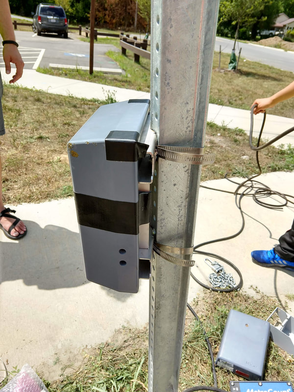
Eco-counter passive infrared sensor: ped |
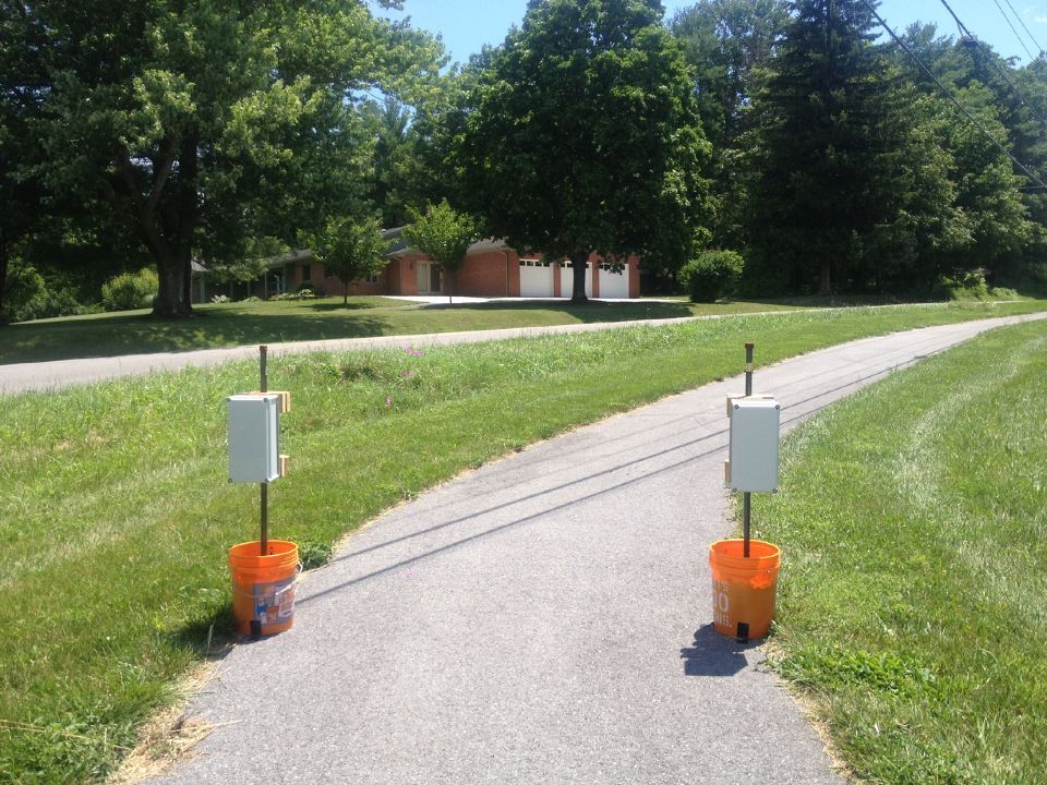
Chambers radio beam: bike and ped
|
Urban informatics
|
Digital data and technology has transformed our modern cities into a "big data" world. This shift calls for a new generation of experts who can use data to understand how cities work. An emerging question is how big data and data science/analytical models can be applied in the urban context.
My work examines built environment, transportation, geography, and environmental health in multiple ways:
|


|
